


 PLANT - MANGROVE

Mangroves are considered the most productive wetlands that sustain and store "blue carbon", with a gross primary production rate of up to five times higher than the other ecosystems.
15%
Despite only making up 1% of tropical forests worldwide, being the only blue-carbon forest, mangroves contain up to 15% of the total carbon that is stored in these sediments and 1% of the world's forests.
10-15%
Climate change threatens mangroves, causing an additional 10-15% loss by 2100.
 SOLUTION
One Platform, Infinite
Mangrove Insights
PLANT brings together high-resolution mapping, automated mangrove habitat gain & loss detection, and AI-powered guidance into a single, intuitive dashboard —so you can turn satellite data into clear, actionable insights for coastal conservation.
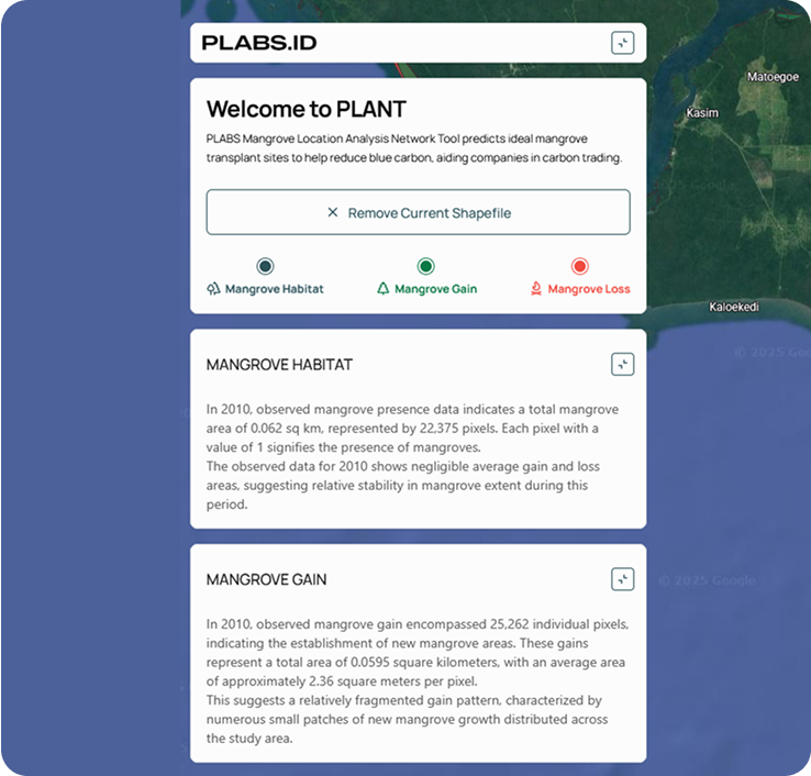
Welcome to PLANT –
Mangrove
PLANT (Global Mangrove Location Analysis Network) brings together high-resolution satellite imagery, advanced geospatial analytics, and an intuitive interface to empower coastal authorities, researchers, and coastal management everywhere.

Habitat, Gain, Loss
Areas in green highlight recent mangrove expansion, while red marks zones of decline— gain/loss status details.

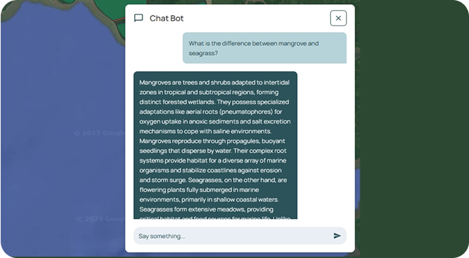
Mangrove, Chatbot
Meet the Mangrove Chatbot your on-demand guide to everything from species to ecosystem services.
Quick Insights Mangrove
Cover, Growth & Decline
Mangrove Insights:
View the total forest extent and stability index, reflecting overall health and persistence over time.
Mangrove Data:
Identify areas of new mangrove establishment, compare with area statistics and growth trends to spotlight restoration successes.
Mangrove Alerts:
Highlight erosion hotspots chronology instead, with clear markers to help you target urgent conservation interventions.
 Company


With passion at our core, we think beyond boundaries and build business to the next level.
Official Website
Inclusive
Foster an open environment built on trust, where everyone feels empowered to be themselves and make impact.

Resilient
Breakdown is an opportunity to a breakthrough. Keep the faith, take risks and growth. But most of all, have fun.

Re-invent
Exploring more and more way of thinking and learning yet problem solving.

360 Feedback
Effective communication is mandatory. Ensure to keep everyone updated, 360° feedback, insightful, and wins.